 |
Hello
I,m mike from Maryland, USA. Way to go Brandon!
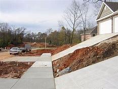
My construction phase's: existing ground (-4" topsoil/not useable at compacted backfill), H.D.P. /mass grading (design ground elev. 2ft+/- above top of pre sited foundation elev., garage 1ft below gar. f.f. elev.), Finished grade (outline at fill limits, 3d contour lines, platform 3d polyline at 1ft below basement elev.)
My software crashes continuously happen when trying to cut in a platform/basement thru finished grade & thru into my mass grading surface. The idea behind our earthwork is to have a mass graded site at an elevation where when the contractor comes to cut in the basement and pour the concrete for the walls/foundation and the spoils from that work are then used to fill/final grade around the structures thus alleviating the need to remove excess earth.
My thought is that the k3 software does not want to cut thru multiple surfaces?
How can i work around this dilemma? should i change when i add the platform, i've tried multiple different solutions to no avail, please help before i lose my mind!
Thanks in advance
Sully
|